![]()
|
|
Personal web pages ofTim Stinchcombe |
|
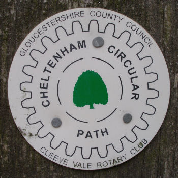
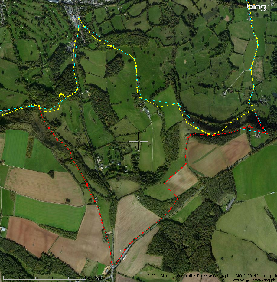
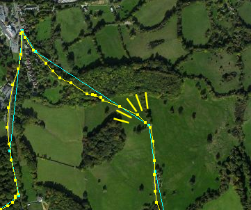
Cheltenham Circular FootpathI discovered the existence of the Cheltenham Circular Footpath quite by chance—I was out walking one afternoon when I spotted one of the marker signs, and so I checked it out on the internet when I got back home. One of the first links I came across was this one at gps-routes.co.uk, which includes this GPX file of the route of the walk itself. I don't have a mobile device which will guide me in real-time across the ground, but I do however have a small GPS 'data logger' which allows me to track where I have actually been. The software that came with the data logger was way too clumsy, so I have been using an open-source (i.e. free to download) program called Viking, which allows plotting of GPS data, and route planning etc, and isn't too difficult to get to grips with. I found that the GPX file linked above, whilst it was useful to get an idea of where to go, was of too low a resolution to help out with some of the finer detail of where the path actually went, and more importantly I recently discovered that at one particular place the route shown doesn't in fact match the signs for the walk on the ground! (More on this later.) I actually walked the path in a piecemeal fashion, by walking radially out from the centre of town where I live to pick up the path, then walk around the path aways, followed by (a sometimes rather tedious it has to be said) walk back in again. I bought a customized OS Explorer map (1:25000, centred roughly mid-way between Cheltenham and Gloucester), but it looks like the standard Explorer map no. 179 from the Ordnance Survey of Gloucester, Cheltenham & Stroud does cover the requisite area. The path is annotated on the map, but just after I had completed what I thought was the entire route, I decided to go back and re-trace a section of it, as I had made a few mistakes and deviated somewhat from the 'correct' path, and this was when I discovered that the paths shown on the map do not match the signs on the ground. The section concerned is to the south-east (click the image for a larger version):
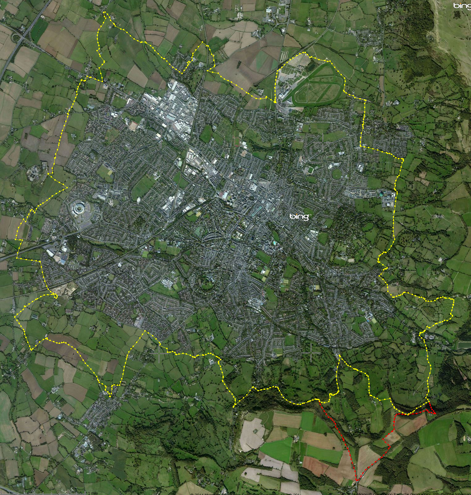
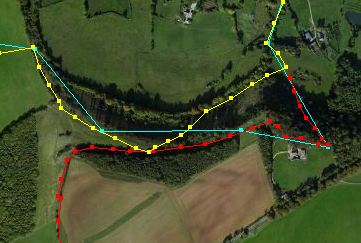
The yellow is what the map would have you believe is the route, though this is open to a little interpretation at the right of the picture (more on that below; the cyan is the route from the GPX file above); the red is where the actual signs on the ground will lead you (though this is most likely clearer when walking clockwise than anti-clockwise—for the latter you'd need to walk some way south from the point where the two paths split to find another post which again bears the 'circular footpath' waymarker). GPX files for the Cheltenham Circular Footpath I have generated two GPX route files for the path based on my actual track over the ground as I walked it. The first is that based on the actual signs on the path, the 'red route' (whilst the files are readable, it would be best to right-click and 'save as', and then load into a suitable GPS-mapping program, such as Viking; I assume other devices like those made by Garmin etc. have the capability to open GPX files too): Clicking the following image will show a reasonably-detailed picture of the routes, largely overlaying each other (created in Viking using Bing aerial photos): the red is that for the 'sign' route, yellow the route based on the map/book:
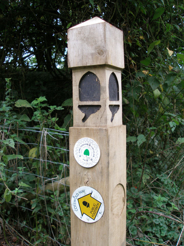
In general it is not too hard to find your way round the actual path: many of the stiles and gates are comparatively new; where a path strikes out directly across a field I found it could be hit-and-miss as to how easy it was to follow it—some farmers had clearly delineated the path, either with markers or by cutting a swath through whatever crop, whilst in others it was impossible to make out where the path actually was (and in several places in my GPX routes you will be able to spot where I have walked around the field rather than across it!) The sign-map-book discrepancy in the south-east cornerSome while after writing the bulk of the above I got hold of a copy of the official guidebook that goes with the path, Cheltenham Circular Footpath (Cheltenham Borough Council, 1996, ISBN 1-873877-17-X), and it is clear that the book and the OS map are in agreement, i.e. the 'official' path follows the yellow route in my photos. How the signs on the ground came to deviate from this I shall probably never know—for the most part through this section they follow the Cotswold Way signage, and I actually took a photo of one of the signs as evidence of this fact—this sign clearly shows a 'circular footpath' waymarker on the distinct acorn-emblazoned posts marking the Cotswold Way (click for larger image):
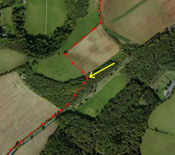
This sign is located at roughly this point (close to the A436):
There is no doubt the red path is easier walking, as where it crosses the A435 the road has climbed up the hill a good deal, so the red path has less descending and climbing to do compared to the yellow one. However it is equally clear that the yellow path has more picturesque views as the brow is breached at roughly this point:
so maybe that swayed it in favour of the 'easier walking'...!? Whilst reading the booklet it also became clear to me that where my yellow route 'cuts the corner' of the red here:
this is in fact part of the Cotswold Way and not specifically part of the circular footpath, which should take the longer (red) way around (I walked down this yellow section, which some may find unnervingly steep; but having said that I continued round in a clockwise direction on the red and so only walked up that part, which in itself is very steep, and so too may not be as inviting in a downwards direction!). [Page last updated: 26 Dec 2014] |